

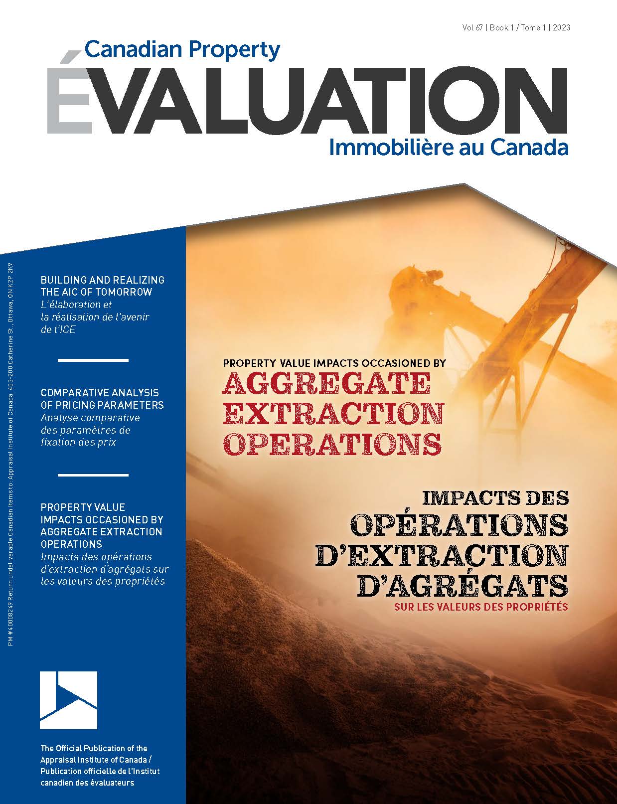
Property value impacts occasioned by aggregate extraction operations
Canadian Property Valuation Magazine
Search the Library Online


This feature represents one section of a more in-depth article authored on this subject by Tony Sevelka. The complete article was published in the Journal of Environmental Law & Policy and can be accessed through the following link: www.grassrootsjournals.org/jelp/0203m00310.html#status
Market Value is the standard measure of the value of property exchanged in an open, active and transparent market, and assumes that the buyer is well-informed or well-advised in making the purchase. Real estate agents, most of whom have little or no understanding of the externalities occasioned by the aggregate industry and the sellers they represent are seldom in the habit of disclosing the adverse effects of an aggregate operation for fear of having to discount the asking price of their property. The argument often presented by the aggregate industry in refusing to acknowledge the detrimental effects that an aggregate operation has on the value of nearby residential properties is premised on the implicit, but unrealistic assumption that a prospective purchaser has an understanding of the adverse impacts to which they will be exposed. …[T]he aggregate industry] should not realistically expect a purchaser to check the county clerk’s office, the planning and zoning commission files, the Army Corps of Engineers, the United States Geological Society, the state geologist, other agencies and the internet, prior to purchasing a house, much less bringing a building inspector, hydrologist, geologist and meteorologist to the site [p. 41].186
In the application of a hedonic pricing model by Guignet (2011)187 designed to measure the impact of an environmental disamenity on house prices, found that, if the sellers and buyers were unaware of the presence of a leaking underground storage tank (LUST), there was no measurable impact on house price. It was stated that:
“Overall, in my hedonic application I find LUSTs [leaking underground storage tanks] generally have little effect on the local home values. I believe this is because buyers and sellers (at least in these housing markets and during this period) are typically unaware of the disamenity. I do, however, find a significant depreciation at homes where I know households are well-informed, as well as in the preference studies where respondents are explicitly informed as part of the study design.”
As important value-influencing information is usually asymmetrical, resting solely with the seller, prospective purchasers overpay for properties impacted by aggregate operations or other disamenites/negative externalities.188 An internet search related to the potential impact of aggregate operations on the value of residential properties in proximity produced the following proximity studies:
Proximity Study One
In a large-scale peer-reviewed study of the impact of rock mines (quarries) on residential property prices, the first of its kind,189 Malikov, et al (2018), documented a sample of 5,500 house sales that took place in Delaware County, Ohio, during the 2009-2011 period (roughly two years). Within the County are four surface rock (limestone) mines (quarries), three of which are no longer operational. The only operational quarry (state mine: Del-5), at 510 acres, also happens to be the largest and is subject to blasting, which creates a far greater nuisance (hazard) than other types of surface mines. It was said explicitly:
“Given that the other mines in the county were no longer in operation by the period of our study and hence did not generate noise, dust and traffic, in our analysis we focus solely on the operational Del-5 mine, which is not only very large but is also located in an area of high urban development.”
Standard software was used to calculate straight-line distances from each property (sale) to the mine centroid of Del-5. The study found statistically significant property-suppressing effects of being located near an operational rock mine (quarry), which gradually decline to near-zero at roughly a 10-mile (16.093-kilometre) distance. For residential property in the middle of the price distribution (r = 0.50), our estimates suggest that, between two identical houses, the one located a mile closer to a rock mine is predicted to be priced, on average, at about 3.1% discount.190 The analogous average discounts for houses in the first and third quartiles of price distribution are around 2.3% and 3.4%, respectively. For an upscale property in the 0.95th quantile [$552,500 average house price], it is at an astounding 5.1%. This is rather expected because of income sorting whereby higher-income households have higher ability to pay for better environmental quality: in this case, distance from a disamenity. Conversely, households with lower incomes and less expensive homes are perhaps more willing to substitute environmental quality for other, more necessary, house characteristics such as easier access to employment, including jobs in the environmental-externality-generating rock mining industry itself.”191
As a back-of-the-envelope welfare calculation using unconditional sample quantiles of house values corresponding to the fitted quantile functions,192 the above discount estimates imply the average loss in property value associated with the house being located a mile [1.609 kilometres] closer to a rock mine ranging from $3,691 to $10,970 for houses within the interquartile range of price distribution. For more expensive neighborhoods in the 0.95th quantile, such losses can be, on average, as high as $28,410. A July 9, 2018 Supplementary Appendix193 of the study includes the following statement:
“Our estimates suggest that, all else equal, a house located a mile [1.609 kilometres] closer to a rock mine is priced, on average, at about 2.3-5.1% discount, with more expensive properties being subject to larger markdowns.”
Proximity Study Two
Professor Hite undertook a study in 2015 that analyzed the property value impacts of rock and gravel mines on house prices in Upstate New York. The study used a large data set of MLS realtor-negotiated house sales (18,941) covering the period of January 1, 2000 to May 7, 2015, with all sales adjusted to current 2015 dollars based on the House Price CPI, in areas surrounding three stone quarries and one sand/gravel pit in Columbia, Saratoga and Rensselaer Counties. The sales surrounding the four mines are from Capital Region Multiple Listing Service (MLS) data, and, according to Hite, use of only Realtor mediated sales in Hedonic Price Models consistently demonstrate lower impacts of disamenities than do those that include all house sales (Jauregui and Hite, 2009);194 “thus estimates of impacts in the current study should be considered underestimates of the true impacts of mines [by about 3.0%].”
Hite’s study, which was relied upon by the Town of Nassau, New York, in its 2015 review of Troy Sand & Gravel Co., Inc.’s application to permit a blasting quarry with an expected life of 150 years on 89 acres (36.017 hectares) of a 216-acre (87.412-hectare) parcel, concluded that:
- Mine operations are a disamenity that would have a negative impact on property values ranging from a 7.5% to 36% discount. Related to these discounts, she concluded (page 12)[195] that ‘These discounts are statistically significant at the 99+% level; such a high degree of significance leads us to conclude that, without a doubt, the quarry Troy Sand & Gravel Co., Inc., proposes to develop and operate in the Town of Nassau, Rensselaer County, New York, will have a deleterious financial effect on existing homeowners [emphasis in original].’
- …[T]here are 293 residential parcels within 1 mile [1,609 metres] of the [proposed] mine site, equating to about 750 people (293 residences at 2.6 persons per household as per US Census Data). That equals about 15% of the Town [of Nassau] population. The Town does not consider this a remote location [p.35].
- To most people, it makes intuitive sense that an operation like a mine – which creates traffic, noise, and dust and that is highly unattractive – would result in nearby house prices being depressed. Statistically based studies have borne out this intuition, and the current study scientifically conservatively demonstrates these impacts…. Dr. Hite’s 1998 article in Land Economics[196] found that individuals who were aware of the existence of a disamenity (in this case, landfills), bid down the prices of houses within 3 miles [4.83 kilometres] by an average of 10.65% as compared to individuals who did not know about the disamenity. The same group of people received further discounts as high as 20% based on how close the homes sought to be purchased were to the disamenity. In addition, because house prices are influenced by comparable sales, even individuals without knowledge of the disamenity received discounted house prices [p.12].[197]
Because uninformed buyers overpay for property impacted by a quarry operation, an acknowledged disamenity, these transactions taint the data pool of comparable sales if they are relied upon by realtors setting asking prices or real estate appraisers estimating market value.
Proximity Study Three
Erickcek’s 2006 study198 of the economic impact of the proposed 853-acre Stoneco Gravel Mine (Pit), when in full operation, concluded that residential property values in Richland and Richland Township, Michigan, would be reduced by $31.5 million, adversely impacting the value of 1,400 homes, which represent over 60% of the Richland residences, with residential properties declining 20% within a half-mile (805 metres) to 4.9% within
3 miles (4,828 metres):
“A residential property located a half mile (805 metres) from the gravel mine (pit) would experience an estimated 20% reduction in value; one mile [1,609 metres] from the mine, a 14.5% reduction; 2 miles [3,219 metres] from the mine, an 8.9% reduction; and 3 miles [4,828 metres] from the mine, a 4.9% reduction. These estimates are similar to estimates published in academic journals on the effects of landfills on nearby property values [p.5].”
“The loss in property value results from the negative consequences of the mining operation and reflects the deterioration in the area’s quality of life due solely to the operation of the gravel mine. In other words, the loss in house value is a way to quantify in dollars the deterioration in quality of life, as capitalized in the price of the house. It captures the price reduction the homeowner would have to offer to induce a new [informed] buyer to purchase the property. Even if homeowners do not move as a result of the gravel mine, they will lose homeowner equity as the potential sale price of their house is less. Therefore, regardless of whether or not a person actually sells their property, it measures the adverse effects in their quality of life in being subjected to the disamenities introduced into the area by the gravel mine [p.6].”
The ‘hedonic pricing model’ relied upon by Erickcek was developed by Professor Hite, Auburn University, based on detailed transactional data from Delaware County, Ohio, for the initial purpose of studying land use planning issues (Erickcek, 2006):
“Hite examines the effects of distance from a 250-acre gravel mine [i.e., blasting limestone quarry] on the sale price of 2,552 residential properties from 1996 to 1998. Her model controls for a large set of other factors that determine a house’s sale price, including number of rooms, number of bathrooms, square footage, lot size, age of home, sale date, and other factors specific to the locality, so that she can focus solely on the effect of proximity to the gravel mine [i.e., blasting quarry] on house values. She finds a large, statistically significant effect of distance from a gravel mine [i.e., blasting quarry] on home sale price: controlling for other determinants of residential value, proximity to a gravel mine reduces sale price. Specifically, Hite reports that the elasticity of house prices with respect to distance from a gravel mine [i.e., blasting quarry] is .097, implying that a 10% increase in distance from the gravel mine is associated with slightly less than a 1% increase in home value, all else the same.199 Conversely, the closer the house to the proximity to the mine, the greater the loss in house value.”
According to Professor Hite, model results presented in elasticity form are particularly difficult for lay people to understand. As a result, Erickcek transformed the elasticity model into a graph that calculates property discounts associated with the estimated model demonstrating that the reduction in house values shown on the graphic (page 5) due to the mine (pit) ranged from 30% adjacent to the mine (pit), to about 5% at 3 miles (4,828 metres) from the mine (pit). While the Hite study relied upon by Erickcek pertains to a blasting quarry, Erickcek justified and explained his reliance on the Hite study to measure the impact of a proposed gravel pit, as if fully operational, on area property values in his December 20, 2006, addendum. The following points are notable in this context:
- Hedonic pricing models have been the standard research technique for evaluating property value impacts for decades.
- The Upjohn report based its estimates of property value impacts for Richland using model estimates from Professor Hite’s research because her research was based on high quality data. In addition, hers was the only study we knew of at the time that used hedonic pricing models to estimate residential property value impacts of mines. Since conducting the study, we have become aware of another study that uses hedonic pricing models, and we have conducted our own analysis based on data for an area gravel mine supplied in an industry consulting report [Sustaining A River: An Economic Impact Study of the Lower Great Miami River Segment Improvements, by Radha Ayalasomayajula, Fred Hitzhusen and Pierre Wilmer Jeanty].
This study used a hedonic price model similar to that used in Professor Hite’s study to estimate the impact of gravel mining operations near the Great Miami River in Butler and Hamilton counties, Ohio. The sample contained sales data on only 119 homes – far fewer than the 2,552 homes Professor Hite had in her sample. The model used in this study accounted for structural characteristics of the individual homes including number of baths, living area, age, number of bedrooms and whether they had a fireplace. In addition, it included the distance from a gravel mine and distance to the closest urban area. The study found that, on average, property values increased by $1,675 per every 1/10th mile [161 metres] the home was away from the mining operation. In other words, the value of a home one mile [1,609 metres] away from the gravel mine would be worth $16,725 more than the identical house located at the mouth of the mine. The study’s analysis limited its impact to only a one-mile radius.200
Although Professor Hite’s data set is ideal for studying these property value impacts, we were uncomfortable basing the Upjohn report on her initial analysis. Professor Hite agreed to do additional work for the Institute [without seeking compensation]… [T]his involved running checks on the data and variable construction, adding control variables, and testing the robustness of her results to model specification. The simulations presented in the Upjohn report were based entirely on new work performed by Hite for the Upjohn Institute and show somewhat lower property value impacts than in her initial report… Professor Hite’s interest in this project is solely to produce high quality research that is publishable in a peer-reviewed, scholarly journal.201
As pointed out by Professor Hite, pits and quarries have a number of opera tional similarities:
“I would like to emphasize that the two types of gravel operations [pits and quarries] are very similar in that, like landfills, they both involve increased truck traffic, noise, and dust and the destruction of large tracts of land… [T]he main difference is that gravel produced at a limestone quarry requires significantly more blasting. To the extent that blasting results in higher average noise or dust levels for area residents, these operations may have larger adverse effects on nearby property values. The adverse property effects from limestone quarries in my study are very large… and… it is improbable that all of these adverse property effects are the consequence of blasting.”
Erickcek also took into account an assessor’s testimony at an August 9, 2006, public hearing held in Howard Township in Cass County on Moose Lake Aggregate’s application for a Conditional Use Permit, confirming that the assessments on 13 residences near the Moose Lake Gravel Mine were reduced by 30% based on his expertise. The estimated 30% reduction in the assessments of these 13 properties is nearly identical to the estimates in the Upjohn Institute study. Later the township assessor revised the negative impact to only 10%; however, upon the protest of two of the homeowners of the impacted properties, the assessor increased the negative impact of the mining operation back up to 30% of the property’s original SEV. The two owners had their properties independently appraised and the Township assessor agreed:
“I believe that if I had the appraisals before…that I probably would have left everbody’s at 70%, but I didn’t have any knowledge of that.” [footnote omitted]
In addition to the obvious adverse impacts (nuisances) of dust and noise generated by the operations of an active gravel pit, which decline with distance from the gravel pit, three other adverse or negative impacts that would not decline so quickly with distance are traffic congestion and traffic accidents, town or community reputation and uncertainty about future development or land use plans, all of which result in a negative impact on residential property values. These are described as below:
- Road Congestion: Still, township residents who do not live along potential truck routes or who reside far enough away from the mine to avoid its dust and noise, will face increased road congestion [and traffic accidents] due to the truck traffic generated by the mine. Gravel trucks can be slow-moving and difficult to pass. Also, due to the lack of sidewalks, the trucks will have to share the road with pedestrians and bicyclists. In addition, while the proposed truck route for the gravel mine stays clear of the Village of Richland, independent truck contractors would be allowed by state law to drive through the Village on M-43 and/or M-89. For some instances, this could prove to be the low-cost route for the independent haulers. If this occurs, it will have a negative impact on the Village’s environment, which would be shared by most all of the township residents.
- Reputation of the area: Just as amenities such as a good school system can improve a town’s reputation and improve property values, the introduction of a disamenity such as a gravel mine can harm the reputation of the area [community], in turn depressing property values. As George Tolley of the University of Chicago writes “people living away from the area, who are not directly affected by the disamenities, view the area as undesirable.”202
- The operation could also alter future development plans for the township. In real estate, uncertainty only decreases land values. Once the mining operation is in place, it can ease the allowance of other heavy industry uses to occur in the township. In short, the gravel mine could open the door to other heavy primary industries. This is the “blight-begets-blight” principle. In fact, one argument cited in defense of having trucks use 24th Street is that it was used before for heavy trucks going to a now closed landfill. In short, this will raise uncertainty about the allowance of other noisy, heavy industries into the region.
Proximity Study Four
In 2020, Kolala et al.203 undertook a study employing the hedonic pricing method (Rosen, 1974)204 to quantify the impact on residential property values in proximity to the Fimiston super pit (quarry) in Western Australia, which measures 3.5 km in length, 1.5 km in width and 360m in depth. Kalgoorlie-Boulder has an estimated population of about 32,000, and the main economic actively is mining, followed by agriculture, manufacturing and processing activities. The most common complaints from residents residing in proximity to the super quarry relate to blasting, noise and dust. To estimate the ‘dis-amenity impact’ of the open pit gold mine on residential property values in the community, sales data for 21,850 residential properties sold in Kalgoorlie-Boulder, between 1990 and 2018, were analyzed, and adjusted to 2012 values using the consumer price index (CPI). The average house sale price in the sample of 21,850 house sales is AU$250,000, in 2012 prices; has a 700 square metre (7,535 sf) lot, three bedrooms, and one bathroom; and is located 3 km (1.864 miles) from the super-pit, 2.5 km (1.553 miles) from the CBD, 1 km from the nearest school, and 0.5 km (0.311 miles) from the nearest park.
The distance between the super quarry and the first street with residential properties is less than 200 metres (656 feet), and the maximum distance to the quarry to residential homes is just under 7 kilometres (4.35 miles). The data set contains information on the sale price, location, and sale date; as well as house features such as the number of bedrooms, bathrooms, lot size, type of roofing, wall construction material, and the year the property was built. The initial data contained over 30,000 sales records, but after data checking and restricting the observations to single-family houses and units within the Kalgoorlie-Boulder metropolitan area, …21,850 complete records [remained]. The maximum distance from a residential home to the super pit is just under 7 km…. Cadastral data were obtained from Landgate, the Western Australian Land Information Authority…. [T]he distance of each house to relevant neighbourhood amenities, (schools, parks, sports facilities and central business district) and dis-amenities (super-pit and the airport) using ArcMap 10.5. Model estimation was… performed [in] R (R Core Team 2019)).205
The study found that residential properties within 2 km (1.243 miles) of the Fimiston super-pit (quarry) trade at a 20% to 30% discount to similar residential properties located at least six to seven km (4.35 miles) from the super pit. It was also concluded that the results of the study provide valuable information for planners seeking to set appropriate buffer zones (separation distances) around mining operations to avoid land use conflicts, while protecting residential property values.
Proximity Study Five
In M & N Materials, Inc. v. Town of Gurley, Alabama, et al., (2015)206 the United States District Court issued summary judgement in favour of the Town of Gurley, upholding the Town’s April 13, 2004 decision to annex a quarry operator’s 266 acres (107.65 hectares), and to prevent quarrying based on a number of potential adverse effects on the environment and the community related to health, safety, morals and general welfare of the Town’s residents. On the issue of property value impacts, Key, a member of the Appraisal Institute, prepared a Proximity Study involving small samples of grouped sales. Key’s Proximity Study grouped sales of modest detached single-family dwellings within 875 feet (267 metres) of the lot boundaries of a quarry that was operational when the sales occurred, compared to a group of sales located beyond 875 feet of the lot boundary of the operational quarry (i.e., the control group). Both groups of sales are from the same subdivision. The purchase price of each sale in both groups of sales were time-adjusted to the effective date of appraisal (November 23, 2004), and relied upon to isolate the impact, if any, the proposed quarry in the Town of Gurley would have on the value of nearby residences within 875 feet (267 metres) of the boundary limits of the proposed 266-acre quarry. Combined, the house sales in both groups ranged in price from $82,000 to $125,000.
Based on the distance parameter of the Proximity Study, Key concluded that residences within 875 feet of the boundary limits of the proposed quarry would sustain an estimated 12.2% diminution (loss) in value, a rate that falls within the 10% to 15% discount suggested by two knowledgeable local realtors. The risk factors associated with a quarry operation to which homeowners are exposed, as identified in Key’s study, include the following:
- Quiet Enjoyment: Noise issues
- Trespass: Dust and airborne particles
- Structural Damage: Blasting
- Ongoing Monitoring: Determining change of structural damage
- Market Resistance: Proximity issues resulting in a diminution in value
The Proximity Study does not indicate the distance from the actual quarry activity (mining and blasting), a point that is more distant than the 875 feet (267 metres) measured from the boundary limits of the quarry. Likewise, the distance from the planned quarry activity (mining and blasting) to its boundary limits of the proposed quarry is not specified. Furthermore, the Proximity Study does not disclose whether the purchasers in both groups of sales were aware of the potential hazards of flyrock, as identified by Ludwiczak, the blasting expert whose testimony in this case was also accepted by the court.
Purchasers relocating from major urban centres to a rural community like the Town of Gurley (2004 population: 874) are unlikely to fully grasp the deleterious effects associated with residing in proximity to a blasting quarry operation, including the dangers of flyrock, which is the ultimate adverse effect due to its potential for injury or death of human and non-human life. If the purchasers in both groups of sales were not fully aware of, or well-advised as to the adverse effects of residing near a blasting quarry, the loss in property value would be expected to be higher. Buyers given the choice of selecting between two homes at the same price and similar in age, quality of construction, building materials, utility and lot size, would avoid choosing the one in proximity to a blasting quarry (or non-blasting quarry).
Conclusion
While aggregate resources are essential for road and building construction, the process of extracting aggregate involves the inevitable destruction of the land from where the aggregate resources are extracted. There are always adverse impacts on the environment occasioned by the processes and operational aspects involved in aggregate extraction, impacts that are magnified as the scale, intensity and duration of aggregate operations increases. The most destructive and dangerous form of aggregate extraction involves quarries that blast rock below the water table, and which have no realistic prospect of rehabilitation. Blasting generates toxic fumes, airblast, ground vibrations and flyrock, an unavoidable by-product of blasting. Repeated blasting has been documented as causing structural damage at a considerable distance from the blast site, despite blasting being conducted within regulatory limits, and despite the aggregate industry’s constant claims to the contrary.
When a blasting quarry operation is permitted to be established in the wrong geographic location, and the adverse impacts on the environment and surrounding community cannot be mitigated to a ‘trivial’ level, the negative externalities, financial and otherwise, associated with the quarry operation are borne by the public and innocent third parties. Not only is the health, safety and welfare of the community compromised, but numbers of comprehensive proximity studies have also concluded that residential properties within a certain radius of blasting quarry operations, as well as pits, are less marketable and sustain a significant loss in property value or home-owner equity. Upscale homes sustain larger losses than more modestly priced homes equally distant from an aggregate operation.
Land use planners acting on behalf of a municipality, county or region, engaged in the processing of applications to permit aggregate extraction have statutory and common law obligations to protect the health, safety and welfare of the communities under their jurisdiction, including the residents’ rights to the uninterrupted use and enjoyment of their properties and to preservation of their property values (e.g., home-owner equity).
A permanent mandatory minimum onsite setback of 500 metres to protect quarry employees, coupled with a minimum offsite radius separation distance of 1,000 metres between the boundary of a quarry and sensitive land uses or activities, existing or proposed, would reduce, but not necessarily eliminate all adverse effects. Other environmental considerations could necessitate enhanced setbacks and separation distances. All other things equal, the more geographically distant a quarry operation is from sensitive or incompatible land uses, deleterious impacts are reduced, including losses in property value.
End notes
186 Demos Binder, The Duty to Disclose Geologic Hazards in Real Estate Transactions,” (1998) 1 (13) Chapman Law Review 13-56. (https://www.chapman.edu/law/files/publications/CLR-1-denis-binder.pdf).
187 Dennis B Guignet, What Do Property Values Really Tell Us? Evidence From Revealed and Stated Preference Studies, Doctoral dissertation University of Maryland, College Park, 2011
188 Neelawala, S.N.S.L.H.P., Asymmetric Information Between Buyers and Sellers in the Residential Property Market, A Hedonic Property Valuation Approach, PhD diss. Queensland University of Technology, 2014. (https://eprints.qut.edu.au/76412/5/S.N.S.L.H.P%20Neelawala%20Thesis.pdf).
189 Emil Malikov, Yiguo Sun and Diane Hite, (Under)Mining Local Residential Property Values: A Semiparametric Spatial Quantile Autoregression, (June 22, 2018) Journal of Applied Econometrics 82-109. (https://onlinelibrary.wiley.com/doi/epdf/10.1002/jae.2655).
190 5.28 thousand feet [one mile] times the mean estimate of 0.58% per 1,000 feet. The average discount estimates for other quantiles of house price are obtained similarly.
191 Cohen and Coughlin (2008) discuss such positive employment accessibility effects associated with environmental disamenities which may counteract negative externality effects in the context of a noise-generating airport.
192 And assuming a constant marginal willingness to pay [footnote 18].
193 (http://qed.econ.queensu.ca/jae/2019-v34.1/malikov-sun-hite/Malikov-Sun-Hite-Mining-Property-Values-Appendix.pdf).
194 Jauregui, A. and Diane Hite, The Impact of Realtors on House Prices near Environmental Disamenities, (2009) 20 (2) Housing Policy Debate 295-316.
195 Diane Hite and Derrick Robinson, The Impact of Hard Rock and Gravel Mines on House Prices in Upstate New York, June 23, 2015.
196 Hite, Diane, Information and Bargaining in Markets for Environmental Quality, (1998) 74 (3) Land Economics 303-316.
197 Diane Hite and Derrick Robinson, The Impact of Hard Rock and Gravel Mines on House Prices in Upstate New York, June 23, 2015.
198 Erickcek, G., An Assessment of the Economic Impact of the Proposed Stoneco Gravel Mine Operation on Richland Township, W.E. Upjohn Institute, 2006, (https://research.upjohn.org/cgi/viewcontent.cgi?referer=https://scholar.google.com/&httpsredir=1&article=1225&context=reports).
199 This estimate is based on a constant elasticity model specification. At the Upjohn Institute’s request, Professor Hite tested the sensitivity of these findings to model specification, and in all specifications finds a large, statistically significant negative effect of proximity to gravel pit on house prices.
The simulations for Richland Township reported below are based on the estimates from the constant elasticity specification and yield slightly lower estimated negative property value impacts than those based on models using other functional forms. We consider this number to be a conservative estimate.
200 The study’s analysis was not as sophisticated as Hite’s model in that it generated a strictly linear estimate of the negative impact of the mining operation on housing prices. Hite’s model generates a more realistic “curved” estimate that declines first at an increasing rate and then at a decreasing rate.
201 Professor Hite received no compensation for her work, despite the fact that is was fairly extensive.
202 George S. Tolley, Effects of the Proposed Indeck Facility on Property Values, Land Use and Tax Revenues. May 2000, unpublished paper, page 6.
203 Kolala, C., Polyakov, M., Fogarty, J., Impacts of mining on property values in KalgoorlieBoulder, Western Australia, (2020) 68(C) Resources Policy.
204 Rosen, S., Hedonic prices and implicit markets: product differentiation in pure competition, (1974) 82 (1) J. Polit. Econ. 34-55.
205 R: Core Team, R: a language and environment for statistical computing, (2019) Foundation for Statistical Computing, Vienna, Austria. (https://www.R-project.org/).
206 M & N Materials, Inc. v. Town of Gurley, Alabama, et al, United States District Court, Northern District of Alabama, Northeastern Division, November 13, 2015, (https://lanierford.com/images/NewsPDFs/federal-court-decision-gurley-alabama-quarry-case.pdf).